R. Piauí, 335 stop - Sunday schedule
| Line | Direction | Time |
|---|---|---|
| 408A-10 | Machado de Assis | 6:24 AM |
| 408A-10 | Machado de Assis | 6:54 AM |
| 408A-10 | Machado de Assis | 7:22 AM |
| 408A-10 | Machado de Assis | 7:42 AM |
| 408A-10 | Machado de Assis | 8:02 AM |
| 408A-10 | Machado de Assis | 8:27 AM |
| 408A-10 | Machado de Assis | 8:57 AM |
| 408A-10 | Machado de Assis | 9:17 AM |
| 408A-10 | Machado de Assis | 9:37 AM |
| 408A-10 | Machado de Assis | 10:02 AM |
| 408A-10 | Machado de Assis | 10:30 AM |
| 408A-10 | Machado de Assis | 10:55 AM |
| 408A-10 | Machado de Assis | 11:15 AM |
| 408A-10 | Machado de Assis | 11:35 AM |
| 408A-10 | Machado de Assis | 12:12 PM |
| 408A-10 | Machado de Assis | 12:49 PM |
| 408A-10 | Machado de Assis | 1:25 PM |
| 408A-10 | Machado de Assis | 1:50 PM |
| 408A-10 | Machado de Assis | 2:15 PM |
| 408A-10 | Machado de Assis | 2:45 PM |
| 408A-10 | Machado de Assis | 3:17 PM |
| 408A-10 | Machado de Assis | 3:47 PM |
| 408A-10 | Machado de Assis | 4:12 PM |
| 408A-10 | Machado de Assis | 4:42 PM |
| 408A-10 | Machado de Assis | 5:07 PM |
Directions to R. Piauí, 335 stop (Consolação) with public transit
The following transit lines have routes that pass near R. Piauí, 335
 Bus: 177H-10, 408A-10, 669A-10, 701U-10, 702C-10.
- Metro: LINHA 4, LINHA 3, LINHA 2.
- Train: LINHA 10, LINHA 11, LINHA 8.
How to get to R. Piauí, 335 stop by bus?
Click on the bus route to see step by step directions with maps, line arrival times and updated time schedules.
How to get to R. Piauí, 335 stop by train?
Click on the train route to see step by step directions with maps, line arrival times and updated time schedules.
How to get to R. Piauí, 335 stop by metro?
Click on the metro route to see step by step directions with maps, line arrival times and updated time schedules.
Bus stops near R. Piauí, 335 stop in Consolação
- R. Sabará, 210, 3 min walk,
- R. Mq. de Itu, 680, 4 min walk,
- R. Sergipe, 177, 5 min walk,
- Parada Antônia de Queiróz (C/B), 6 min walk,
- Parada Antônia de Queiróz (B/C), 6 min walk,
- Av. Angélica, 1281, 6 min walk,
Metro stations near R. Piauí, 335 station in Consolação
- Higienópolis-Mackenzie, 9 min walk,
- Santa Cecília, 11 min walk,
- Consolação, 11 min walk,
Bus lines to R. Piauí, 335 stop in Consolação
- 408A-10, Cardoso de Almeida,
- 475M-10, Term. Amaral Gurgel,
- 508L-10, Aclimação,
- N840-11, Sta. Cecília,
- 874T-10, Lapa,
- 877T-10, Vl. Anastácio,
- 7245-10, Term. Sto. Amaro,
- 909T-1, Terminal Pinheiros - Terminal Parque Dom Pedro Ii,
- 178L-10, Lauzane Paulista - Hospital Das Clínicas,
- 669A-10, Terminal Santo Amaro - Terminal Princesa Isabel,
- 701A-10, Parque Edu Chaves - Metrô Vila Madalena,
- 701U-10, Metrô Santana - Cidade Universitária,
- 702C-10, Jardim Bonfiglioli - Metrô Belém,
- 702U-10, Cidade Universitária - Terminal Parque Dom Pedro Ii,
- 702U-22, Metrô Butantã - Terminal Parque Dom Pedro Ii,
- 778R-10, Cohab Raposo Tavares - Terminal Princesa Isabel,
- N801-11, Metrô Butantã - Terminal Parque Dom Pedro Ii,
- 8700-1, Terminal Campo Limpo - Praça Ramos De Azevedo,
- 875A-10, Aeroporto - Perdizes,
- 909T-10, Terminal Pinheiros - Terminal Parque Dom Pedro Ii,
What are the closest stations to R. Piauí, 335?
The closest stations to R. Piauí, 335 are:
- R. Sabará, 210 stop is 178 meters away, 3 min walk.
- R. Mq. de Itu, 680 stop is 284 meters away, 4 min walk.
- R. Sergipe, 177 stop is 380 meters away, 5 min walk.
- Parada Antônia de Queiróz (C/B) stop is 435 meters away, 6 min walk.
- Parada Antônia de Queiróz (B/C) stop is 439 meters away, 6 min walk.
- Av. Angélica, 1281 stop is 447 meters away, 6 min walk.
- Higienópolis-Mackenzie station is 654 meters away, 9 min walk.
- Santa Cecília station is 817 meters away, 11 min walk.
- Consolação station is 836 meters away, 11 min walk.
Which bus lines stop near R. Piauí, 335?
These bus lines stop near R. Piauí, 335: 177H-10, 408A-10, 669A-10, 701U-10, 702C-10, 8700-10, 8707-10.
Which metro line stops near R. Piauí, 335?
LINHA 4 (Luz)
Which train lines stop near R. Piauí, 335?
These train lines stop near R. Piauí, 335: LINHA 10, LINHA 11, LINHA 8.
What’s the nearest metro station to R. Piauí, 335 in Consolação?
The nearest metro station to R. Piauí, 335 in Consolação is Higienópolis-Mackenzie. It’s a 9 min walk away.
What’s the nearest bus station to R. Piauí, 335 in Consolação?
The nearest bus station to R. Piauí, 335 in Consolação is R. Sabará, 210. It’s a 3 min walk away.
What time is the first metro to R. Piauí, 335 in Consolação?
The LINHA 4 is the first metro that goes to R. Piauí, 335 in Consolação. It stops nearby at 4:41 AM.
What time is the last metro to R. Piauí, 335 in Consolação?
The LINHA 3 is the last metro that goes to R. Piauí, 335 in Consolação. It stops nearby at 12:45 AM.
What time is the first bus to R. Piauí, 335 in Consolação?
The N801-11 is the first bus that goes to R. Piauí, 335 in Consolação. It stops nearby at 3:07 AM.
What time is the last bus to R. Piauí, 335 in Consolação?
The N801-11 is the last bus that goes to R. Piauí, 335 in Consolação. It stops nearby at 3:20 AM.
R. Piauí, 335 station
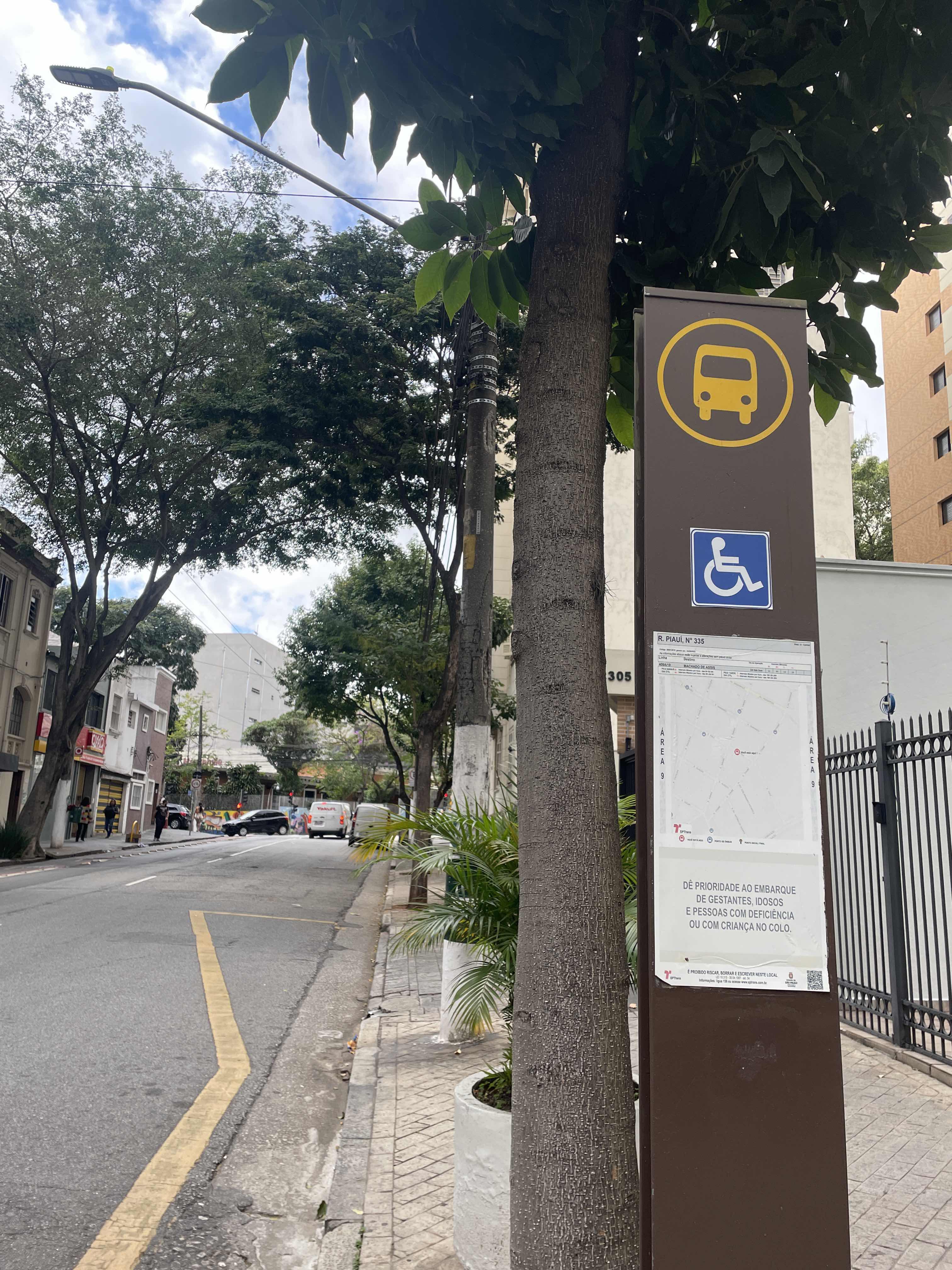 Taken by Anonymous
See R. Piauí, 335 stop, Consolação, on the map
Public transit to R. Piauí, 335 stop in Consolação
Looking for directions to R. Piauí, 335 in Consolação, Brazil?
Download the Moovit App to find the current schedule and step-by-step directions for Metro, Train or Bus routes that pass through R. Piauí, 335.
Looking for the nearest stops closest to R. Piauí, 335 ? Check out this list of closest stops to your destination: R. Sabará; R. Mq. de Itu; R. Sergipe; Parada Antônia de Queiróz (C/B); Parada Antônia de Queiróz (B/C); Av. Angélica; Higienópolis-Mackenzie; Santa Cecília; Consolação.
Bus: 177H-10, 408A-10, 669A-10, 701U-10, 702C-10, 8700-10, 8707-10, 475M-10, 508L-10, N840-11, 874T-10, 877T-10, 7245-10.Metro: LINHA 4, LINHA 3, LINHA 2.Train: LINHA 10, LINHA 11, LINHA 8.
We make riding on public transit to R. Piauí, 335 easy, which is why over 1.7 billion users, including users in Consolação trust Moovit as the best app for public transit.
Use the app to navigate to popular places including to the airport, hospital, stadium, grocery store, mall, coffee shop, school, college, and university.
The first line to this stop is 408A-10, at 6:24 AM, and the last line is 408A-10 at 12:54 AM.
274 Rua Piaui, São Paulo, Brazil
This stop serves SPTrans’s lines
- R. Sabará, 210,
- R. Mq. de Itu, 680,
- R. Sergipe, 177,
- Parada Antônia de Queiróz (C/B),
- Parada Antônia de Queiróz (B/C),
- Av. Angélica, 1281
Bus stops near R. Piauí, 335 stop
- Higienópolis-Mackenzie,
- Santa Cecília,
- Consolação
Metro stations near R. Piauí, 335 station
- R. Quartim Barbosa, 40,
- Av. Hebe Camargo, 73,
- Avenida Professor Ascendino Reis, 560,
- Avenida Antonelo da Messina, 650,
- Av. João Peixoto Viegas, 586,
- Butantã,
- Carapicuíba,
- Pf - Vila Belmiro,
- R. Leopoldo Couto de Magalhães Júnior, 758,
- Rua Rodovalho Júnior 637,
- Av. Rio das Pedras, 3620,
- Av. Escola Politécnica,
- Avenida Marginal do Csu 2340,
- Rua General Glicério,
- Cidade Jardim,
- Avenida Ariston Azevedo 75,
- Av. Inconfidência Mineira, 1225,
- Terminal Bandeira,
- R. Paineira do Campo, 45,
- Av. Ultramarino
Popular public transit stations in Consolação
Get around Consolação by public transit!
Traveling around Consolação has never been so easy. See step by step directions as you travel to any attraction, street or major public transit station. View bus and train schedules, arrival times, service alerts and detailed routes on a map, so you know exactly how to get to anywhere in Consolação.
When traveling to any destination around Consolação use Moovit's Live Directions with Get Off Notifications to know exactly where and how far to walk, how long to wait for your line, and how many stops are left. Moovit will alert you when it's time to get off — no need to constantly re-check whether yours is the next stop.
Wondering how to use public transit in Consolação or how to pay for public transit in Consolação? Moovit public transit app can help you navigate your way with public transit easily, and at minimum cost. It includes public transit fees, ticket prices, and costs. Looking for a map of Consolação public transit lines? Moovit public transit app shows all public transit maps in Consolação with all Bus, Train, Metro, Light Rail, Ferry, Gondola, Cable Car and Funicular routes and stops on an interactive map.
Sao Paulo Region has 8 transit type(s), including: Bus, Train, Metro, Light Rail, Ferry, Gondola, Cable Car and Funicular, operated by several transit agencies, including SPTrans, CPTM, ViaMobilidade, Aquático SP, SPTRANS, EMTU, ViaQuatro, Auto Ônibus Moratense, GRU Airport (Aeroporto de Guarulhos), Auto Viação Urubupungá (Cajamar), Viação Cometa, Auto Viação Urubupungá (Osasco), Viação Ultra / Rápido Brasil, Auto Viação Urubupungá (Santana de Parnaíba) and Expresso Luxo